
Maps
of U.S. Exploration
These
maps show the way the U.S. was settled and the people who
explored it.
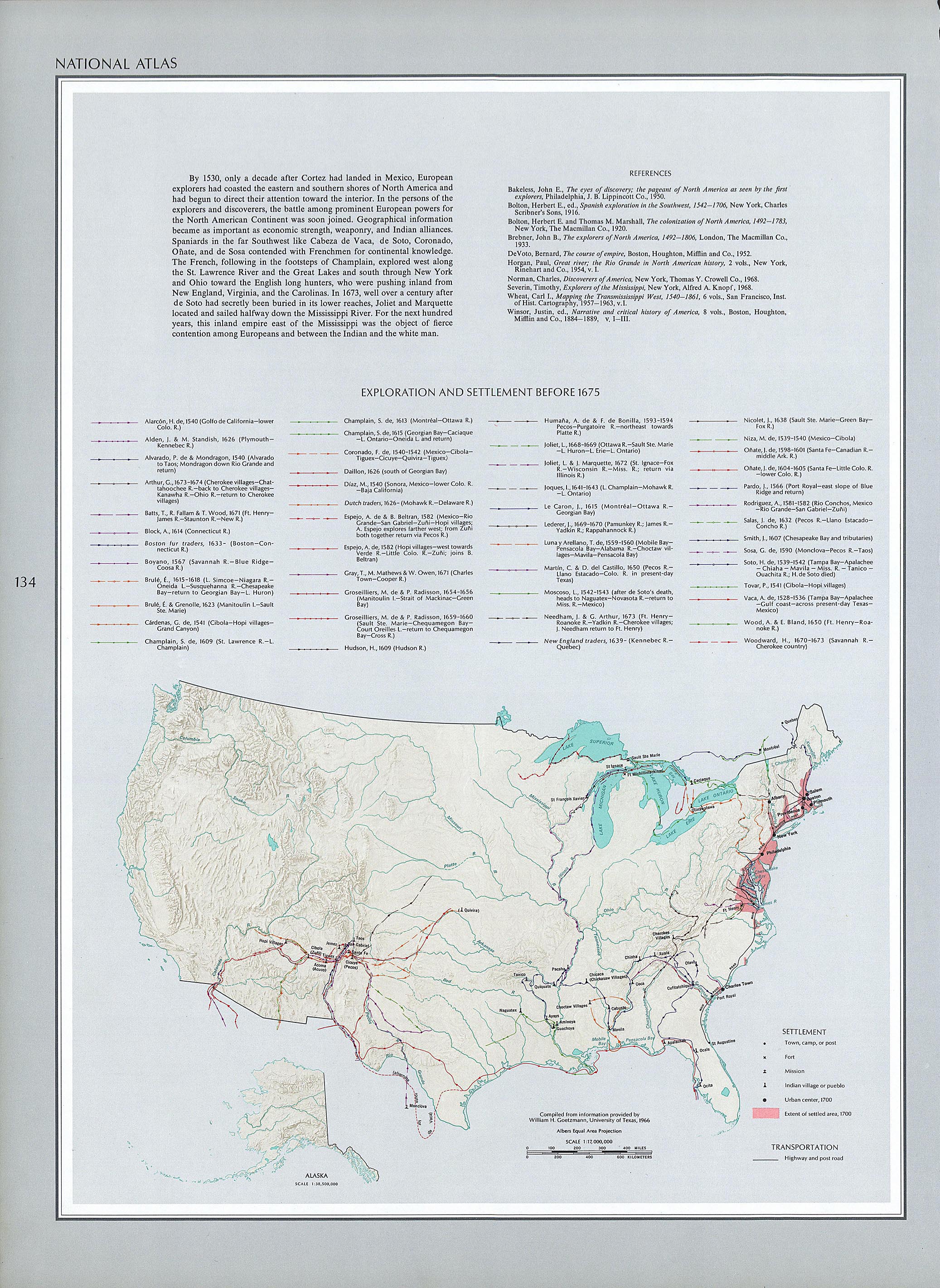
Before
1765
See the country right after the conclusion of the French and
Indian War.
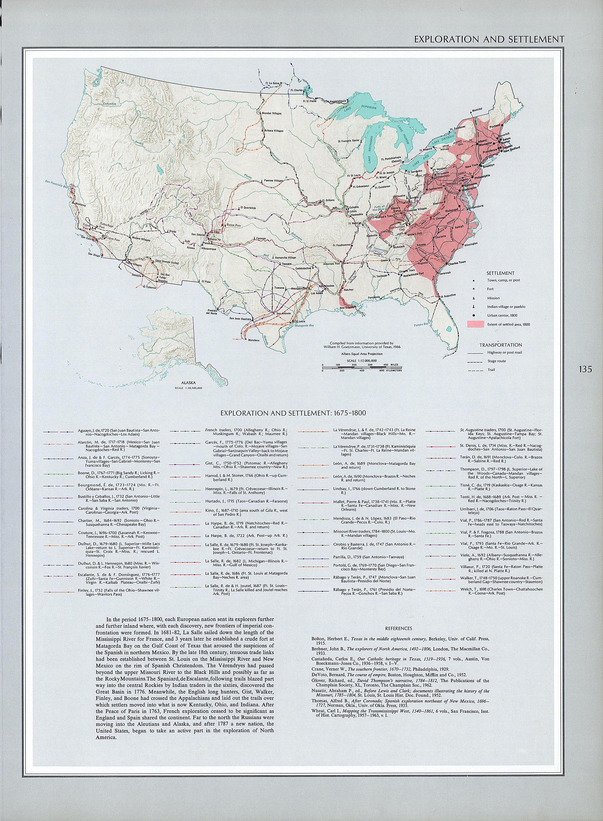
1675-1800
See the country from before the Revolutionary War to the
beginning of the 19th Century.
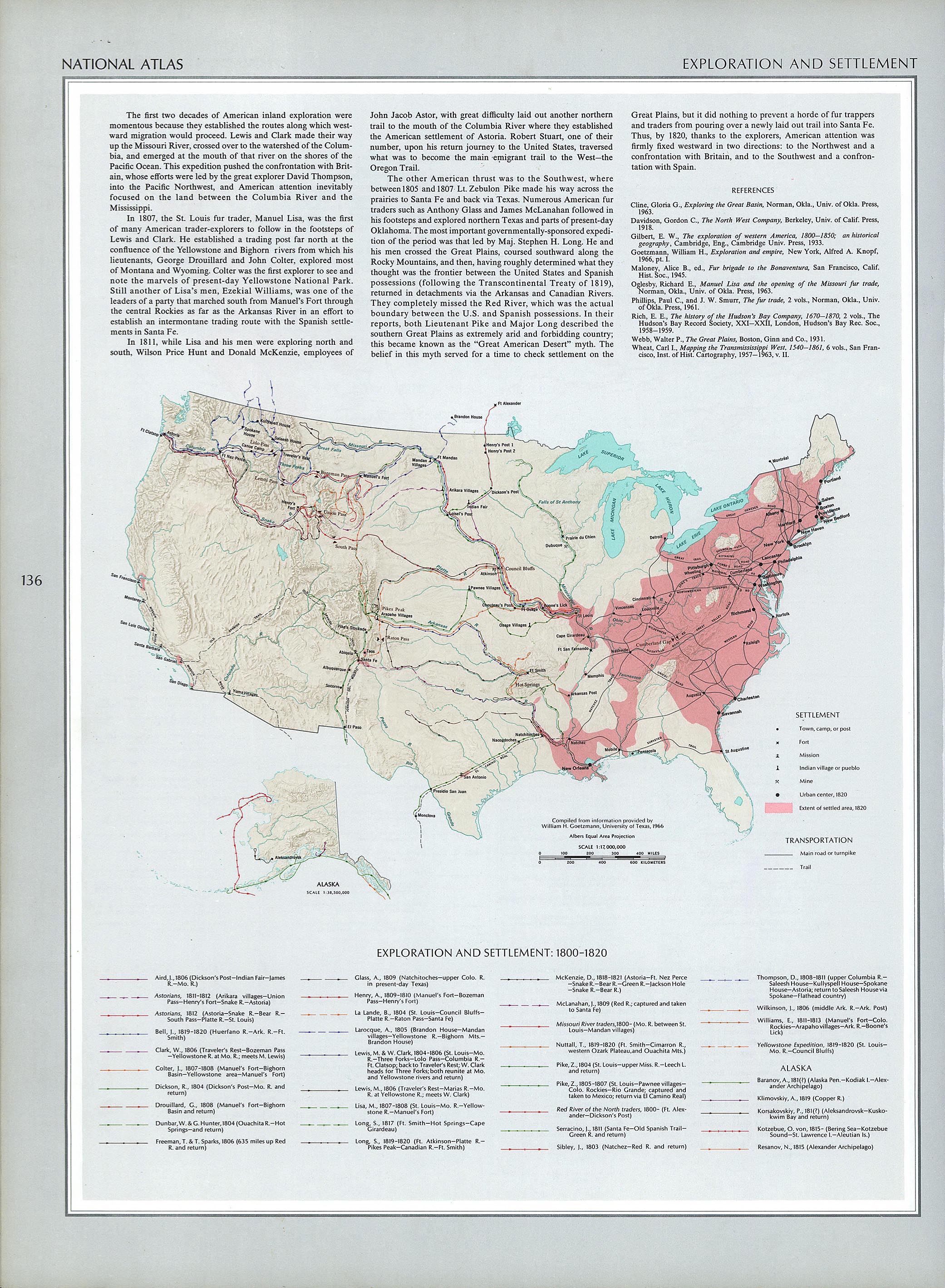
1800-1820
This map includes the Louisiana Purchase (1803) and the
Missouri Compromise, two momentous events in American
history.
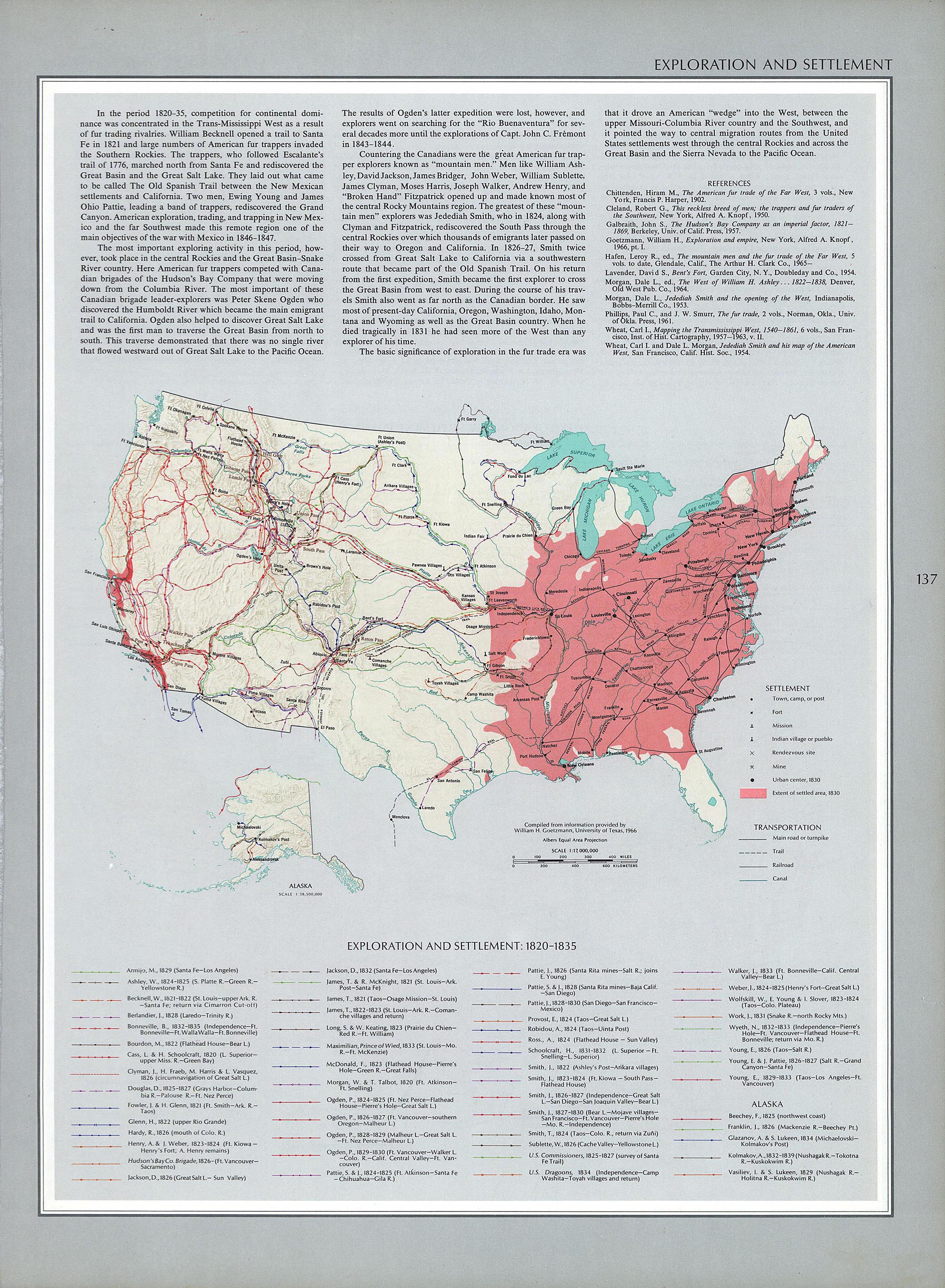
1820-1835
This map shows a lot of cool things, including westward
trails.
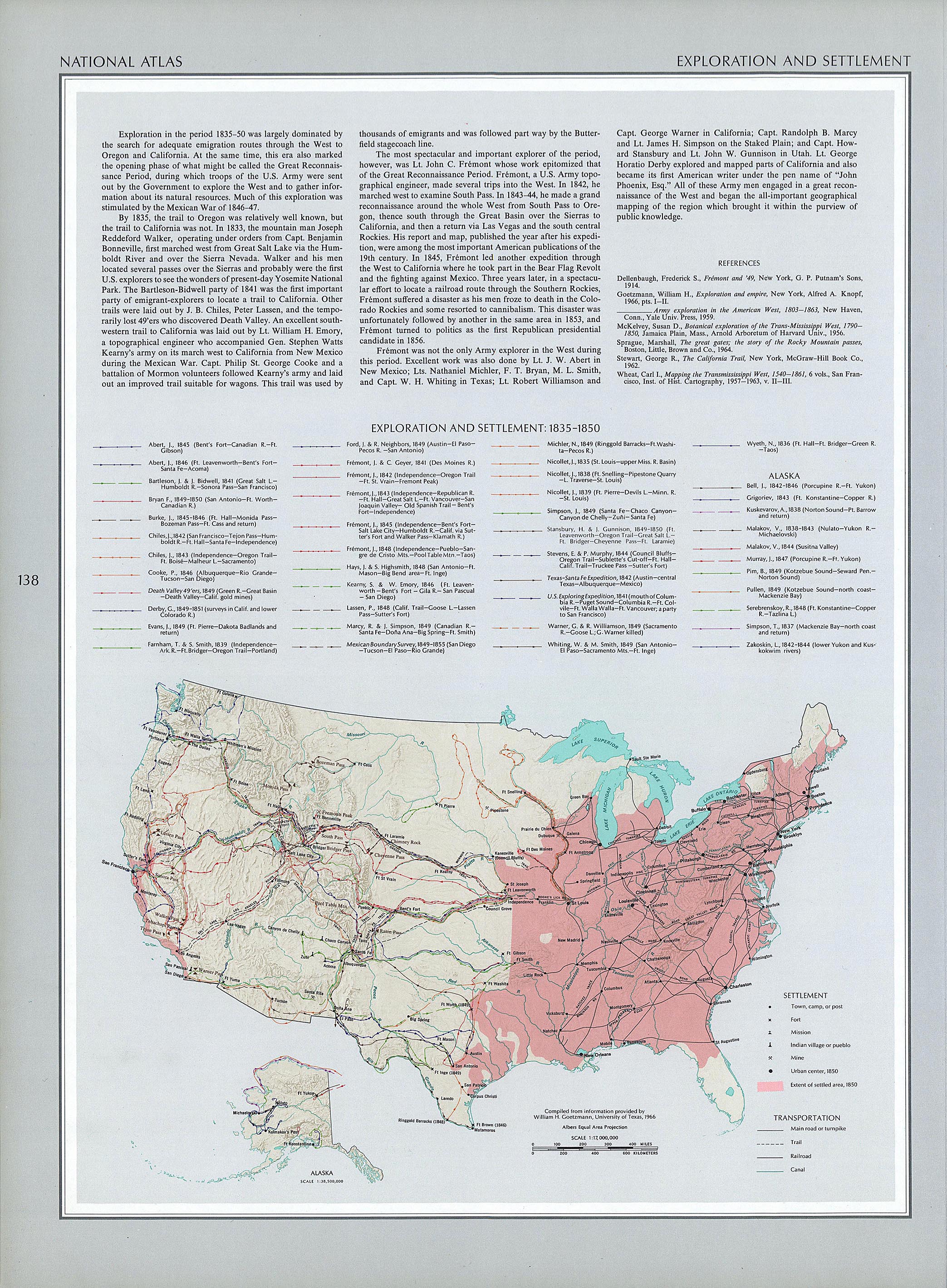
1835-1850
A few more states enter the union, and the country still
doesn't solve the "slavery problem."
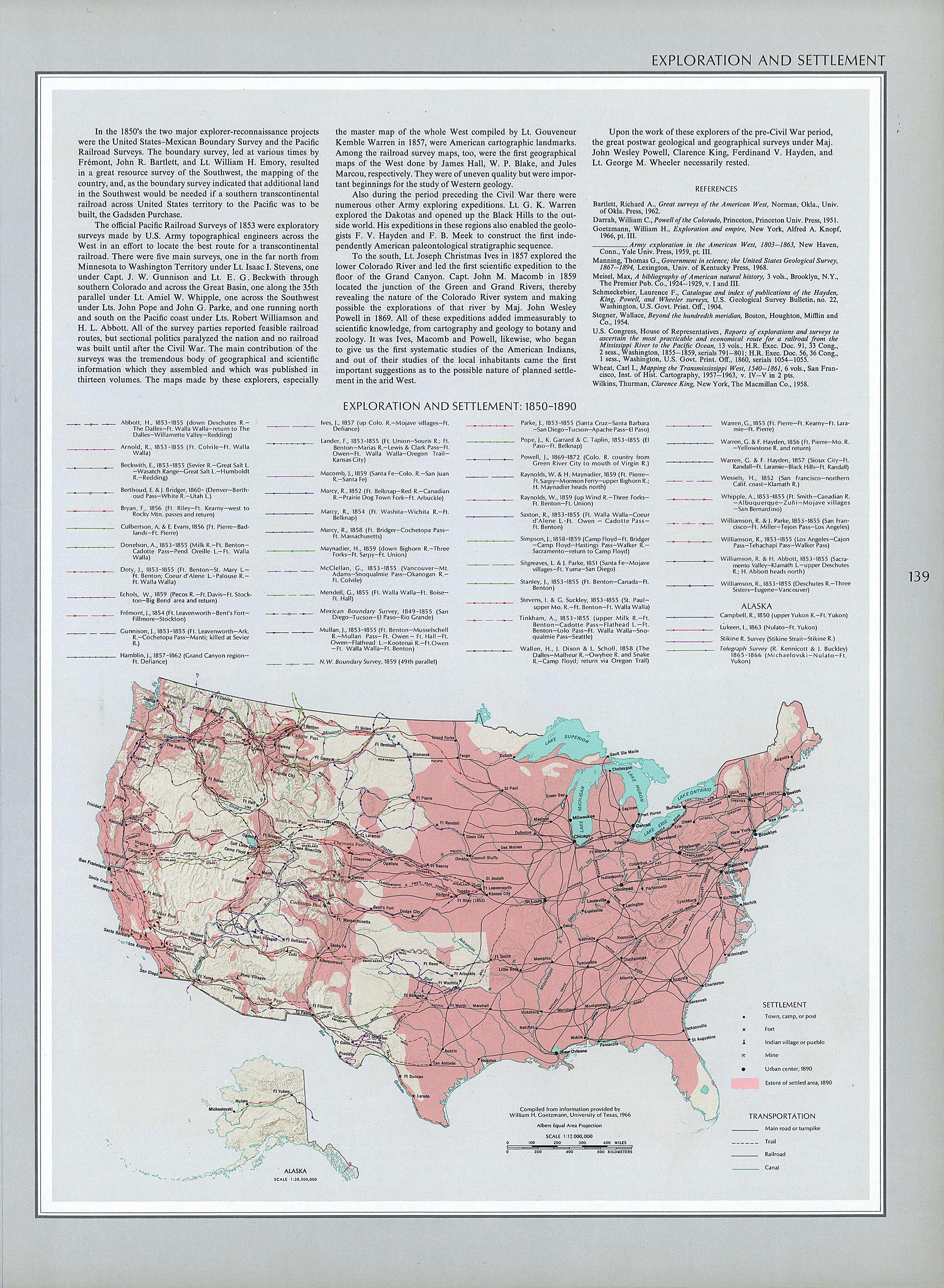
1850-1890
This map is the first in the series to show railroads! It
also shows a few more states, westward trails, and canals
and turnpikes.
Chisholm
Trail
More than just a cattle trail, the Chisholm Trail stretched
from Texas to Kansas.
Oregon
Trail
Possibly the most famous trail of all, the Oregon Trail
stretched from Missouri across the West to the Pacific
Coast, in Oregon.
California
Trail
Just like it sounds, the California Trail led to California.
It started in the Midwest, and its main travelers were
people who wanted a more "golden" life out West.
Santa
Fe Trail
This trail, another famous one, stretched from Missouri to
Santa Fe, in what would become New Mexico.
Bozeman
Trail
This trail began as a gold-rush trail. Many people traveled
from the Midwest to Bozeman, in what would become Montana,
in search of ways to get rich quick. Others came to
stay.
Cherokee
Trail
This trail was yet another way to get to California,
beginning the South, near what would become Oklahoma, and
continuing to the gold fields of the West.
|
