The Making of the 50 States: South Dakota
Part 1: In the Beginning Early cultures in what is now South Dakota included the Woodland, Mound Builder, and Plains Village peoples. Native Americans living in the area included the Arikara, Arapaho, Cheyenne, Chippewa, Crow, Dakota Sioux, Ioway, Lakota Sioux, Mandan Pawnee, and Ponca. In the latter part of the 18th Century, these tribes fought with one another. 
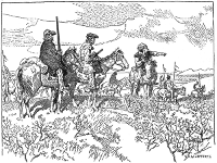
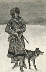
Mirroring the experience of many neighboring states, South Dakota found itself claimed by France when the explorer Robert Cavelier, Sieur de La Salle came through the area in 1682. As with North Dakota, it was Louis-Joseph and Francois La Verendrye who are thought to have been the first European to visit the area, in 1743. They buried an inscribed lead plate near what is now Fort Pierre. Further visits from French explorers and traders followed. Well-known trappers and traders included William Henry Ashley, Manuel Lisa, and Jedediah Smith. The English explorer David Thompson produced the first known map of the Dakota area in 1787. Jean Baptiste Trudeau opened a trading company in the area in 1794. In the meantime, however, French control of the area had ended in 1762, amidst the French and Indian War, and Spain gained control of all French territory west of the Mississippi River. France The first American explorers were the members of the Lewis and Clark expedition, who went through in 1804, on their way to the Pacific. In their wake was established a fur trading post, at what is now Fort Pierre. They returned to the area two years later. 
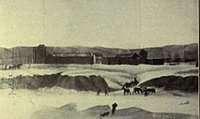
Americans got into the fur trading business, with the formation of the St. Louis Missouri Fur Company in 1808. Following not long afterward were the American Fur Company, the Columbia Fur Company, and the Rocky Mountain Company. As the American presence in the area grew, the American military presence in the grew as well. Americans built Fort Manuel in 1812. The fort was the site of a battle during the War of 1812. At Fort Pierre, site of a trading post inspired by Lewis and Clark, came a permanent settlement in 1817, established by Joseph La Framboise. More trading posts followed. More explorations followed in the 1830s and 1840s, led by John C. Fremont and John J. Audobon. The U.S. Army assumed control of Fort Pierre in 1855 and then left it two years later, after the completion of Fort Randall. The partitioning of the Louisiana Territory directly affected what is now South Dakota in 1812, when the area to the east of the Missouri River became part of the Missouri Territory. This eastern area was then included in the Michigan Territory in 1834, the Wisconsin Territory in 1846, and the Minnesota Territory in 1849. The western part, meanwhile, became known as the Mandan Territory and became part of the Nebraska Territory in 1854. Next page > The Rest of the Story > Page 1, 2
|
|
Social Studies for Kids
copyright 2002–2026
David White


 assumed control again in 1800, mirroring events in Europe in which France took control of Spain. French ownership of the area ended in 1803, with the
